
Various sectors have been radically altered as satellite monitoring systems provide new solutions and synergetic data. Organizations use these systems to optimize operations, create efficiency, and expand their business.
Organizations across various sectors leverage satellite monitoring solutions to gain near-daily, high-resolution insights into Earth’s changing landscapes, enabling timely and informed decision-making. In this article, we look at some of the industries that are benefiting immensely from satellite technology.
Agriculture Satellite Monitoring
Agriculture Satellite monitoring is one of the primary beneficiaries. Satellite data assists farmers in monitoring crop health, soil conditions, and weather patterns. This data allows them to make better decisions, netting higher yields while wasting less. Early detection of pests can be achieved, as satellite imagery can identify whether there are any pest infestations. It also helps manage the water so that it is irrigated correctly. These advancements enable sustainable agricultural practices that benefit producers and consumers.
Environmental Conservation
Environmental organizations use satellites to monitor deforestation, wildlife habitats, and the effects of climate change. That’s why satellite data are scalable and accurate indicators of land use and land use change, enabling conservationists to design effective interventions. Satellites help in the fight against illegal logging by monitoring forests. They are also fundamental in monitoring endangered species and provide data for conservation. By protecting natural resources, this technology helps conservationists achieve ecological balance.
Logistics & Transport
GIS satellite systems are used in navigation and fleet management in the transportation sector. By tracking vehicles in real time, on-time delivery becomes possible, and route planning becomes efficient. The satellites can also be fuel-efficient and cost-effective, thus lowering operational costs. The satellites can provide accurate positioning data, essential in shipping and air travel. They enhance safety through weather forecasting and surveillance of environmental conditions. Such monitoring allows logistics companies to improve efficiency, ensuring that products are delivered to their destinations seamlessly.
Disaster Management
Satellite tracking is always invaluable during calamities. Using satellite imagery, they can view damage, plan rescue operations, and devote resources where needed. It provides a holistic view of the impacted location, allowing for coordinated responses. Satellites can predict events such as hurricanes and floods, and these models will enable the implementation of early warnings and prevention methods. Satellites help reduce losses of life and property in emergencies by providing essential information.
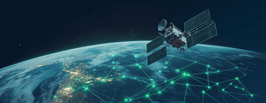
Telecommunications
Satellite technology supports the telecommunications industry a lot. Satellites provide international accessibility, a resource highly beneficial to even the most distant and underserved areas. They offer internet, television, and communication network services. This connectivity supports business, education, and health, helping to close the digital divide. When terrestrial networks fail, satellites provide unlimited, reliable communication services during emergencies and save lives. With continuing demand for connectivity, satellites remain a key enabler of global expansion.
Mining and Resource Exploration
Satellites can help identify minerals by providing high-level geological information that assists exploration. With this information, companies can determine possible locations for mining; therefore, businesses no longer need to survey every area on land. Additionally, environmental monitoring is done through satellites to ensure that the mining activities comply with established regulations.
Urban Planning and Development
Urban planners use satellite data to identify land use trends, evaluate demand for infrastructure development, and track urban sprawl. This process helps develop sustainable cities with a more efficient use of resources. Tracking pollution levels ensures a healthier environment, and satellites help with that. Satellites also provide the maps and data planners need to overcome problems such as traffic congestion and a lack of housing. Informed decision-making supported by satellite technology encourages balanced urban development.
Conclusion
Satellite monitoring systems have grown in importance for common industries. These systems can provide valuable observations and answers, from agriculture to urban planning. Industries derive value from satellite data to enhance operational efficiency, promote sustainability, and uphold responsible practices. The advancement of technology will further expand the applications of satellite monitoring, spurring further development.